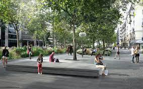
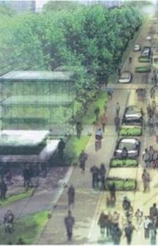
As part of the redevelopment and potential landfilling of Route 13 (RN13 from La Défense to Etoile) in Neuilly-sur-Seine, which was heavily polluted at the time (air and noise pollution), a public consultation of local residents was conducted in order to choose between several scenarios. The program covered 1,400 meters of axis 13 (RN13), and its impact on the buildings bordering the axis, ie approximately 30,000 m² of neighboring areas.
The acoustic firm Tisseyre + Associés has developed a methodology for joint work with architects and urban planners, particularly relevant in the context of neighborhood redesign projects and public consultation as is the case with axis 13. Indeed, our tool digital 4D modeling of soundscape in the future state of completion, the BIMAE®, is an essential work support for close collaboration with architects and urban planners at all stages of the project. By modeling the sound evolution during a day of transport routes and human activities, our tool checks the acoustic balance between these different sound sources in order to avoid nuisance.
Acoustic diagnosis of the pre-existing situation
Together with the engineering firm Fluidyn, we first identified all the sources of pollution, noise on our side and atmospheric for Fluidyn. Thus, thanks to BIMAE®, we have developed 3D sound level maps at different times of the day and night. These maps not only served to visually identify the existing sound stress points but also served as a basis for comparison with the various redevelopment scenarios subsequently proposed during the consultation.
Forecast sound maps according to several scenarios
According to several possible scenarios and the forecast state of the flow of the transport routes, depending on the depth and the length of the burial of the axis 13 track, we modeled several maps of the sound levels in the future state. of completion. The maps of the different scenarios allowed a better visualization of the noises and therefore understanding of the trade-offs to be made during the public consultation. Ultimately, it was the second partial hedging scenario that was selected and then carried out
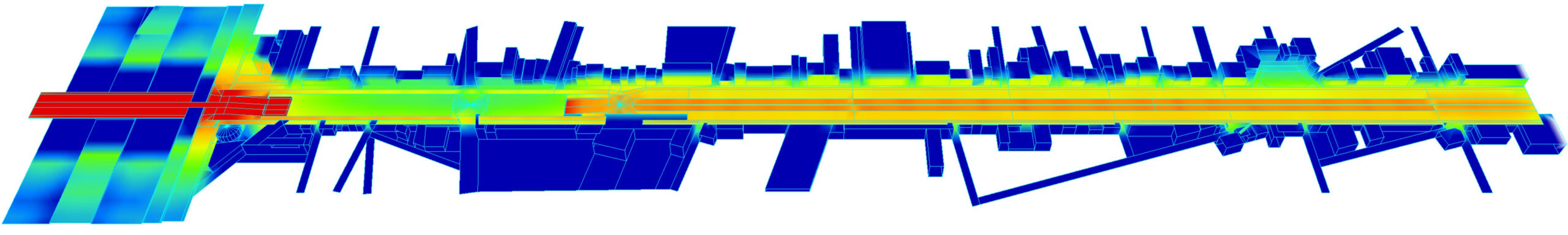
Mapping of daytime sound levels with burial scenario B
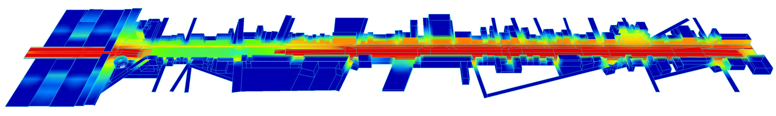
Mapping of sound levels along the water before works